


We all kind of laughed at the potential title to this post but in some ways, it was kind of true. Syed Hyder, Mark” the Shark” Sauers, John Casuccio and his daughter Haley, Pete Hilton and I all made the trek to Snowshoe, West Virginia to take in the UCI World Cup Mountain Bike Races and do some riding in the always challenging trails of West Virginia. Little did we know that our ride in the Tea Creek area would turn into probably one of the most challenging rides we have ever done all due to a navigational error. But we will get into that in a bit. First things first. We started out with a nice ride at the Baker’s Ridge trails near the WVU campus with our good friend Roger Evans. He led us around these beautifully created trails as a first stop on our way south.
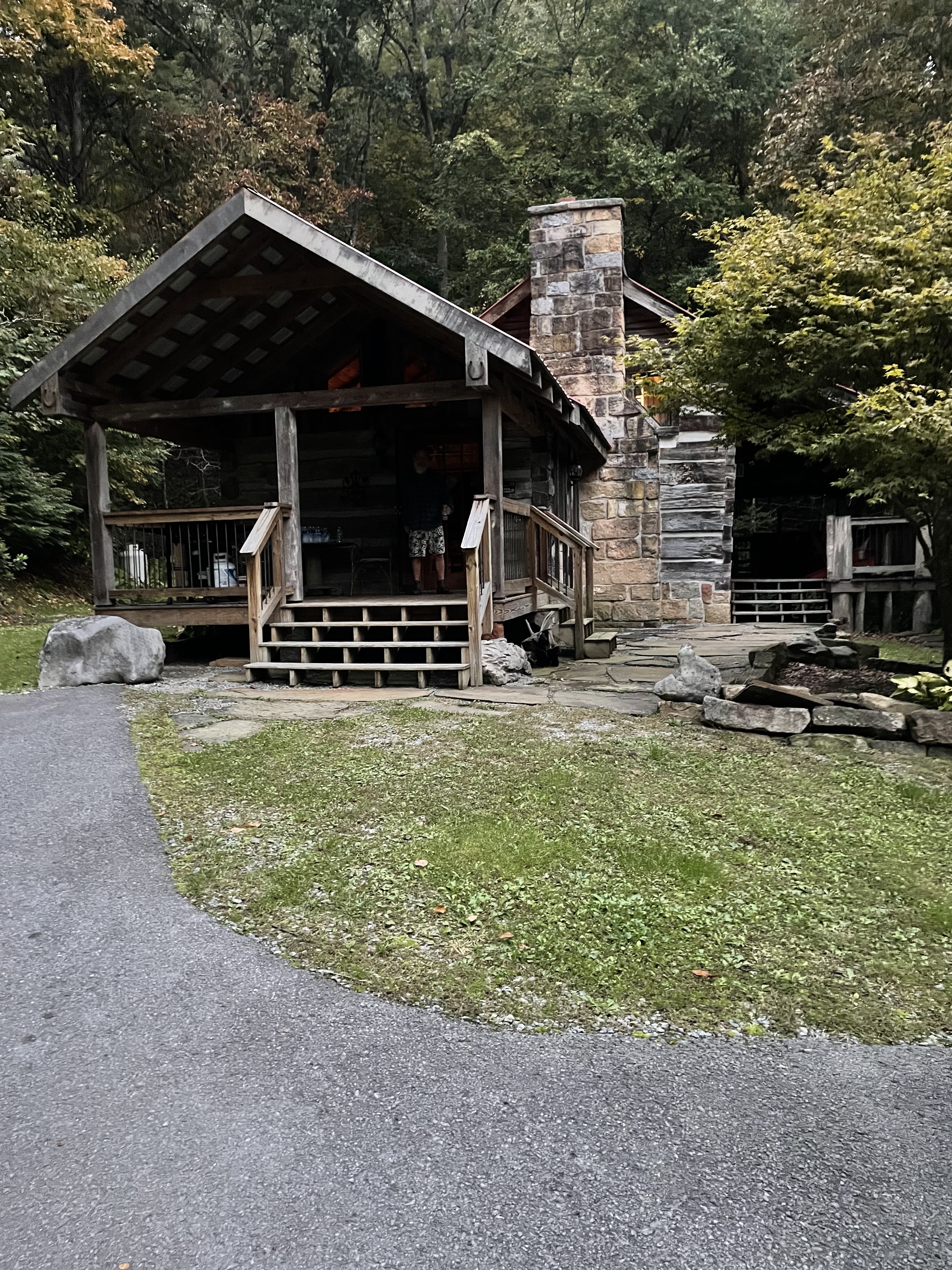
Moving towards Slaty Fork and Marlinton after the ride, we made our way to a wonderful cabin at the Jerico Bed and Breakfast complex. The cabins there are restored pre-Civil War structures that are truly spectacular. If you ever want a nice place to stay- look no further than the Jerico and rent one of those beautifully restored cabins. https://jericobb.com
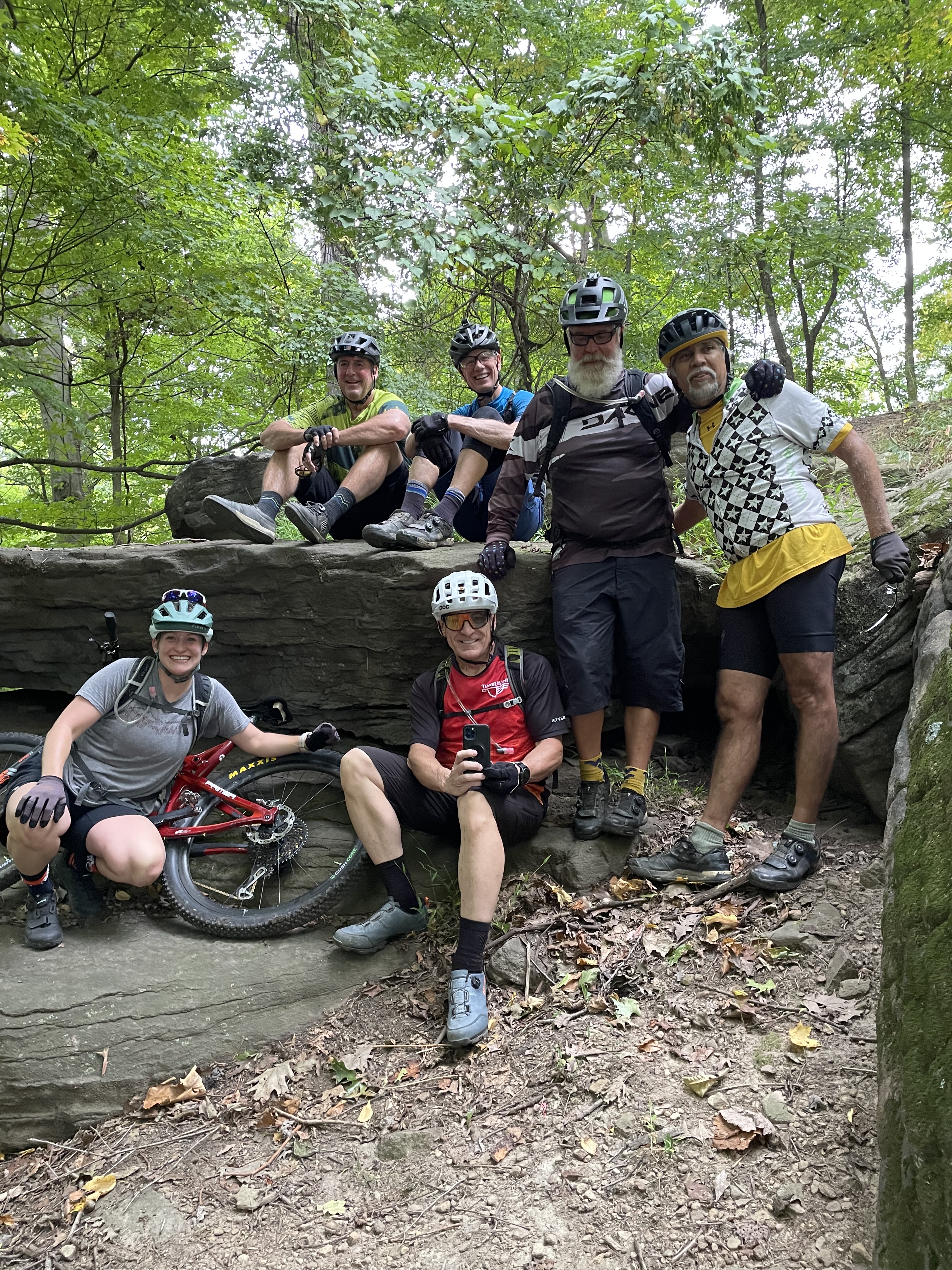
After settling into the Lee Cabin, we awoke the next morning to a spectacularly sunny day with the changing leaves all holding court for our visual enjoyment. John and I had discussed the route on the Tea Creek ride prior to the trip and had agreed on a plan to take us down the Gauley Mountain Trail, making a right turn on the Bear Pen Trail which would eventually end up on a fire road which we could take back to the lot, or we could add a few miles by rerouting on some of the trails generally around the parking area. John and Haley had downloaded the map on their Garmin devices and I went old school with my map of the area from the old Wild 100 days. I have had a lot of experience riding in that region and had a pretty good idea of the good routes versus the tough routes. John suggested that we make a right turn on the way down the Gauley Mountain trail which deviated from our plan. But we were all cool with it as we were challenged on the rocky, rooty, always slimy terrain. As Shark would say, ” it gets West Virginia in a hurry” once you begin riding anything in that region and the Gauley Mountain Trail and the Red Trail were no different. You always have to keep your speed up because momentum is your friend. As soon as you slow down and think too hard about what is in front of you, trouble ensues.


Had we decided to go all the way down, we could have hit the Tea Creek Mountain Trail which several of us had ridden before. That would have led us to the Tea Creek campground with an easy out on the Bannock Shoals trail to the fire road to the finish. But what could have been a nice “Gilligan’s Island” three hour tour turned into a true backcountry slogfest when our only route out was the Tea Creek Trail which was clearly marked on my map as ” not recommended”. I knew when we were headed there that it would be a very challenging route out. Most of it was unrideable and it even would be challenging as a hiking trail with multiple stream crossings before the trail ended.
We all tried to keep our shoes dry by handing each other our bikes and gingerly crossing the slimy rocks in the Tea Creek. But by the time we hit the 6th stream crossing, we all basically were trying to get across the best way we could which included hip deep wading and steep banks on the other side where we once again pushed our bikes up the steep inclines out of the creek and passing the bikes up the bank when needed. Our shoes were soaked and the going got tougher when we tried to ride some sections out. Shark fell and banged his noggin and had some blood on his lip which caused his Confederate general, snowwhite beard to sport some red. Doc Hyder made sure he was ok and we plodded on primarily pushing our bikes over four miles of steep, rocky, unrideable terrain. Along with the usual annoyances of stepping on ground bees nests and getting multiple stings, falling in the creek, getting pounded by the relentless uphill rocks, roots, and mud bogs, we finally escaped the Tea Creek Trail and made our way back to the fire road and ultimately to the parking lot……………..5+1/2 hours after we began. Including a half hour lunch break of pre-packed peanut butter and honey sandwiches. Always a winner and a life saver on long rides.
West Virginians are tough as we saw several of them on the rides plowing their way through everything. They are used to this challenging terrain, but our crew held our own in what was truly a backcountry adventure leading me to the conclusion that any deviations from the mapped plans can lead to more than we would bargain for. Haley, the mother of two young kids, was undaunted by it all and showed that once again, youth is wasted on the young. She was amazing.
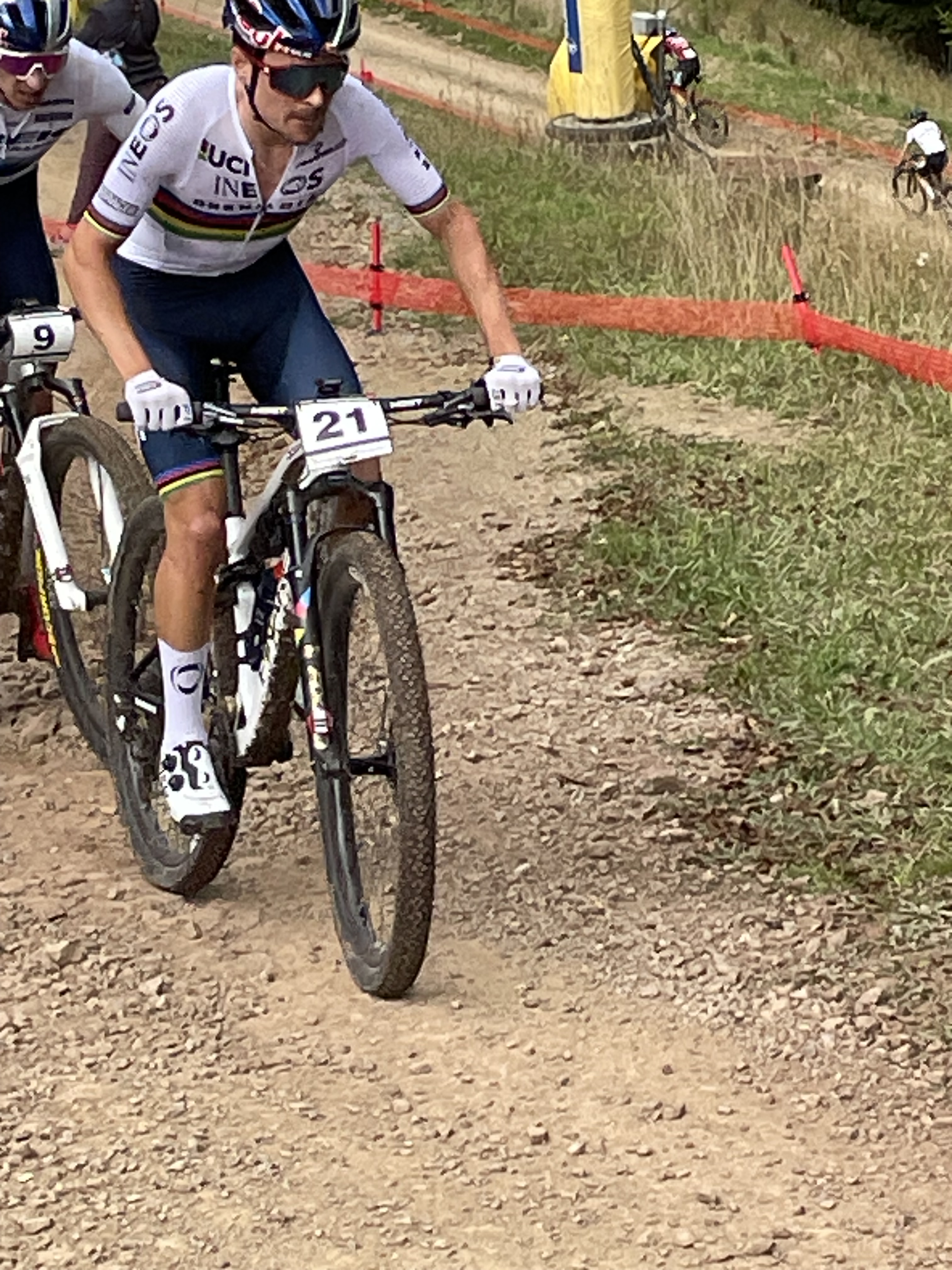
The World Cup Races were fun to watch especially the downhill on Saturday. The fitness displayed by the XC racers on Sunday was amazing to see as well as they are all the best in the world and we had the good fortune to see them up close. Snowshoe does a great job putting on these races every year and hopefully the UCI schedule will permit another wild, wonderful event in the premier showcase resort in the area.

I am getting a little long in the tooth for 5+1/2 hour rides, slogs, hikes or whatever you want to call it. But sometimes age and treachery survives ,and I will be back to try the new 30 mile trail system currently being developed near Marlinton. This system we are told, will be an IMBA Gold Trail System- the first on the East Coast. This will bring Marlinton well into the game of being a top- rated destination spot for mountain bike riding. But I will be using my maps for sure and not deviating from the plan. However, if it were not for the deviation, we would not have had the adventure we had. So, no problem, John. A fun adventure. Sometimes you have to deviate. Thanks for reading.
